Weather or Not
We’ve had a rather cold snap here lately. We’re in the last 1/3 of May and I’ve had frost on the ground most mornings this week. On a whim I checked the forecast for ZIP 85326, which is where my dear old Grandpa lives. Buckeye, Arizona is a small burg in Maricopa County southwest of Phoenix. I think there is a gas station and a Circle K convenience store.
Most, if not all, of their water gets piped in from the Colorado River, through the Roosevelt Irrigation Ditch. If a farmer wants to irrigate his field (the growing season is 11 months long!) he submits an application to the water authority. They send back a note saying “We’ll turn on your water at 11am next Tuesday”.
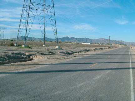
Given the desolate nature of this area, I was surprised to come across this real estate listing:
49.82± Acres Town of Buckeye, Maricopa County, Arizona
Location: The offered property is located on the southwestern quadrant of Dean Road and Lower Buckeye Road, in the stripped annexed areas of the Town of Buckeye. The site is located 2.5 miles south and 1 mile west of the I-10 – Verrado Way Interchange, (which does not connect to Airport Road south of I-10 at the present time), and approximately 7 miles northeast of downtown Buckeye.
Acreage: 49.82± tax roll acres of land. The property is currently farmed. The cropland is in the Roosevelt Irrigation District, water is received from a District turnout. The property is bisected by four large electrical transmission lines. The Seller indicates that there is approximately 38 acres net of the powerline right of ways.
Water Rights: Approximately 45± irrigation acres, with an irrigation water duty of 5.34 of per irrigation acre.
Zoning: Maricopa County Rural - 43,000, (R-43), a one acre minimum residential/agricultural zoning district. Under the existing Buckeye Plan for Future Development, the subject is designated as Planned Residential.
Flood Hazards: Per FEMA Flood Map #04013C, Panel 2045G, dated 7/19/01, the offered property is located in a Zone X area, an area outside of the 100 year flood hazard area.
Utilities: There are no City water and sewer utilities in the area. Utilities typical to the neighborhood include:
Telephone: Qwest is the primary carrier in the area, and various cellular and long distance carriers.
Electric: APS.
Water: Domestic wells are permitted.
Natural Gas: Southwest Gas, and various bottled gas suppliers.
Sewage: Individual septic tanks.
Television: Antennae or various satellite services.
Price: $1,995,000 -or- $40,044 per gross acre -or- $52,500 per acre net of the power lines and roads
Terms: Cash
Did you get that? $40Gs per acre for desert wasteland!!!! Granted, it is NOT in a flood zone.
As I type, the rain is pounding down at a furious rate. We're under a tornado watch. Or a warning, I can never remember the difference.
Grandpa says it rains about 4 times a year at his place. He has a sky-light (literally a square hole in the roof) over his kitchen sink. If it ever does rain, he gets free dishwater. I find this funny as hell, don't ask me why.
posted by 40angst @ 4:22 PM
0 comments
![]()
![]()

